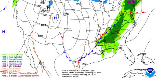
Alabama Skies: A front is moving through Alabama. When will the rainy weather end? When is the next round of severe weather could be on its way?
Published 9:02 pm Thursday, February 22, 2024
A front is quickly moving through Alabama with some clouds and rain. If you’re hoping for a pattern change of nicer weekends instead of the rain and storms we’ve had the past few weekends, you’re in luck. Any rain is expected to move out of the state by early Friday morning, leaving behind some clouds and gusty winds.
Skies will clear in the north part of the state early with gradual clearing throughout the state as the day continues. The rest of the weekend will be sunny, warm, and breezy.
We’re keeping an eye on models for the middle of next week. Forecasts can and will change, but the Storm Prediction Center is already monitoring the potential for some severe weather. According to their severe weather statement, there is a better chance for strong to severe storms the farther north one travels in the state.
North Alabama
Partly cloudy early, then becoming sunny with a high of 66. Clear Friday night with a low of 41.
Central Alabama
Mostly cloudy in the morning, then gradually clearing. High of 64 with wind gusts up to 20 miles per hour. Mostly clear overnight with a low of 44.
South Alabama
Cloudy in the morning with a slight chance of a shower or thunderstorm. High of 69 and wind gusts up to 20 miles per hour. Clear overnight with a low of 44.
Gulf Coast
Mostly cloudy, then gradually clearing. High of 73 with wind gusts up to 20 miles per hour. Clear overnight with a low of 46.


