Two tropical storms form Friday, one in Gulf another in Atlantic
Published 4:47 pm Friday, October 25, 2019
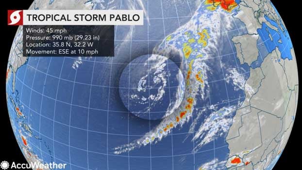
A late-season tropical storm sprang to life on Friday over the Gulf of Mexico and was given the name Olga, the 17th-named storm of the Atlantic hurricane season. And far out over the Atlantic Ocean, Tropical Storm Pablo formed late Friday afternoon.
Olga will likely be short-lived as a tropical storm, forecasters say, but will be part of a one-two punch of tropical moisture drenching the Gulf Coast throughout the weekend.
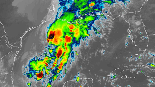
AccuWeather meteorologists say that two separate storms have formed in the Gulf of Mexico. The first of which was located closer to the United States coastline and it is expected to remain non-tropical in nature, according to Dan Kottlowski, AccuWeather’s top hurricane expert. However, it was unleashing a rainstorm across the South through Friday and is expected to move inland and impact the Midwest and Northeast.
The storm farther south, the second punch, is the one that developed into a tropical depression Friday morning and then strengthened into Olga on Friday afternoon.
But Olga only has a very “short window for strengthening” AccuWeather Senior Meteorologist Adam Douty said, before a cold front sideswipes it and causes it to weaken.
“The system will not have a lot of time to strengthen before moving onshore, so the feature will not become a hurricane,” Douty added.
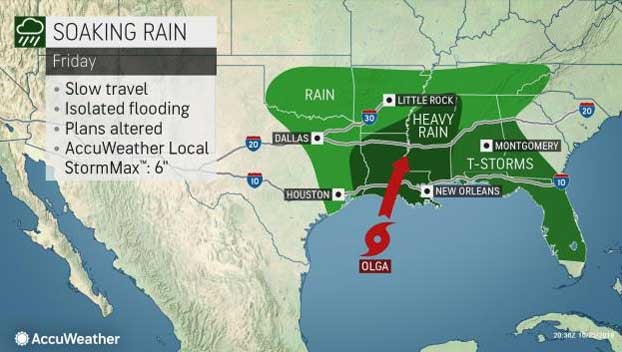
Even if it only maintains tropical-storm strength for a brief time, moisture associated with it will stream northward into the Deep South and enhance rainfall in part of the region. The enhanced downpours could lead to numerous flooding incidents, even in areas experiencing long-term drought.
The last time a storm formed over the Gulf of Mexico this late in the season was when Juan took shape in 1985, according to Philip Klotzbach, a Colorado State University meteorologist.
AccuWeather meteorologists expect the center of the system to move ashore along the Louisiana coast, far west of New Orleans, on Friday night.
Americans in the storm’s path can expect copious amounts of rain and gusty thunderstorms northward from the central Gulf coast and the lower Mississippi and Tennessee valleys as it merges with the non-tropical storm in the region from Friday into Saturday.
The AccuWeather RealImpact™ Scale for Hurricanes is less-than-one for this storm and is based on the amount of rain to fall over the South Central states with an AccuWeather Local StormMax™ of 6 inches.
Meanwhile, a second tropical storm took shape on Friday afternoon.
A rapidly strengthening disturbance became Tropical Storm Pablo on Friday afternoon in the Atlantic Ocean near the Azores.
Pablo poses no threat to the United States or Atlantic Canada, but it could impact the Azores over the weekend, as well as shipping in the area.